Solar drone inspection software plans drone flights over a solar plant, handles the images and finds faults such as hot panels. Sitemark ranks first on this list, at 78.9/100.
What does solar drone inspection software do, from flight plan to orthomosaic?
A drone inspection has four stages. You plan the flight, capture the images, stitch them into a mapped orthomosaic (one big stitched map image), then analyse it for faults. This page ranks tools on the first three stages and on how cleanly they pass the map on for analysis.
Most buyers are utility-scale and C&I (commercial and industrial) owners, O&M (operations and maintenance) providers and EPCs (engineering, procurement and construction firms). Residential installers fly drones for roof surveys instead. Scanifly, the only residential tool we scored, is in Also considered. Our solar site survey apps page may suit them better.
Fault classification, temperature readings and reports are covered on our companion page, best solar thermal inspection software. If inspections are one part of your maintenance work, see solar O&M software. For the control-room day on a utility plant, see solar farm management software. This page sits in our aerial and thermal inspection category.
Quick picks
Rank | Product | Best for | Starting price (company page, checked October 2026) | Free plan / trial | Score /100 |
|---|---|---|---|---|---|
1 | Own or partner capture, construction to O&M | Quote only | Demo only | 78.9 | |
2 | In-house flight planning and orthomosaics | ✓ USD 4,188 per year (single user) | 14-day trial, no card | 76.7 | |
3 | Pay-per-MW analysis of imagery you already fly | ✓ EUR 20 per MW inspected | 14-day trial. EUR 0 per MW self-analysis tier | 66.6 | |
4 | Docked autonomous drones on utility-scale fleets | Quote only | Demo only | 65.6 | |
5 | Outsourced aerial capture across large portfolios | Quote only | Demo only | 60.2 | |
6 | Construction-phase drone scans tied to QA and punch lists | Quote only | Demo only | 58.2 | |
7 | DJI FlightHub 2 + Thermal Analysis Tool (general drone software) | DJI fleets planning routes on a 3D model of the plant | ✓ Thermal tool free. FlightHub 2 Enterprise USD 3,280 per device per year | Free thermal tool | 55.5 |
✓ Verified on the company’s own pricing page. ◐ Published by the company outside its pricing page (help centre, store or press release). ? We could not read the company’s pricing page, so the figure is not confirmed. Prices checked October 2026.
Quote only means the company shows no public price. You ask it for a quote.
How the 7 tools scored
- Use-case fit 35%
- User reviews 20%
- Pricing 15%
- Ease of use 10%
- Support 10%
- Momentum 10%
Tool | Score chart | Score |
|---|---|---|
78.9 out of 100 | 78.9 | |
76.7 out of 100 | 76.7 | |
66.6 out of 100 | 66.6 | |
65.6 out of 100 | 65.6 | |
60.2 out of 100 | 60.2 | |
58.2 out of 100 | 58.2 | |
DJI FlightHub 2 + DJI Thermal Anal | 55.5 out of 100 | 55.5 |
Each bar shows the weighted score out of 100.
Sub-scores at a glance (0-10)
Product | Use-case fit | User reviews | Pricing | Ease of use | Support | Momentum | Total /100 |
|---|---|---|---|---|---|---|---|
9.2 | 7.9 | 4.0 | 10.0 | 10.0 | 5.0 | 78.9 | |
7.5 | 7.5 | 7.0 | 7.5 | 7.5 | 10.0 | 76.7 | |
7.5 | 7.4 | 7.0 | 5.0 | 5.0 | 5.0 | 66.6 | |
9.2 | 5.0 | 4.0 | 5.0 | 5.0 | 7.5 | 65.6 | |
8.3 | 5.0 | 4.0 | 5.0 | 2.5 | 7.5 | 60.2 | |
8.3 | 5.0 | 4.0 | 5.0 | 5.0 | 3.0 | 58.2 | |
DJI FlightHub 2 + DJI Thermal Anal | 5.0 | 5.0 | 7.0 | 5.0 | 5.0 | 7.5 | 55.5 |
A 5.0 on reviews, ease, support or momentum is our neutral value where public evidence is thin, not a judgement.
How did we rank these drone inspection tools?
How the score is weighted
- Use-case fit 35%
- User reviews 20%
- Pricing 15%
- Ease of use 10%
- Support 10%
- Momentum 10%
We considered 14 products and scored 12 from 22 to 25 October 2026. We ranked the top 7, and the other 5 are listed under "Also considered". We used company documentation, pricing pages, trade press and public user reviews. This was desk research: we did not fly or process data in any tool. We scored each product on six tests:
- Use-case fit (35%): How well it does this page’s job. We look for documented capture, processing and solar fault analysis, then the asset and work features around them.
- User reviews (20%): G2 and Capterra ratings. Ratings based on only a few reviews count for less, and most platforms here have few or none.
- Pricing (15%): Published pricing scores higher than prices you have to ask for.
- Ease of use, support and momentum (10% each): Review sub-scores and dated release notes. Each is neutral without evidence.
Products whose core facts we could not confirm on the company’s site lose 2 points. General drone tools are scored on the same rubric and labelled, and service-led companies on their software only. SurgePV is not part of this ranking. Full method: how we score software.
One finding applies to every product here. We found no IEC 62446-3 (the standard for thermal imaging of PV plants) fault classification on the company pages we checked. Contracts and lenders sometimes refer to that standard in general terms. If yours does, ask the company for a sample report before you buy.
Who flies: software, services or you?
Decide who will fly before you compare scores.
- You fly, software plans and processes: DroneDeploy and DJI FlightHub 2 plan missions. DroneDeploy also builds the orthomosaic.
- You fly or upload, software analyses: Sitemark, Scopito and Raptor Maps. Raptor Maps also takes aircraft, satellite and third-party data.
- The company flies: Zeitview flies and runs its own software. Sitemark has a partner capture network and Scopito a full-service tier.
- Nobody flies by hand: Raptor Solar Sentry and DJI Dock 3 with FlightHub 2 run docked drones on schedules or alerts. Docked drones sit in a base station on site.
1. Sitemark: best for bring-your-own-drone or partner capture, construction to operations
Best for: EPCs, O&M providers and owners who want one platform from construction QC (quality control) to O&M. Score: 78.9/100.
What it is: Sitemark is a drone inspection and work platform from Sitemark NV in Leuven, Belgium. It covers solar, BESS (battery storage) and grid assets. EPCs, O&M providers and asset owners use it.
Why we picked it: It joins solar fault detection to your own drones or a partner capture network. Its reviews are among the best here, at G2 4.9/5 from 30 reviews.
Key features:
- Drone thermal and visual inspections. It finds MC4 (standard PV connector) faults, soiling, tracker issues, cracking, vegetation, storm damage and serial numbers.
- Bring your own drones or book partner capture, plus a drones and robotics module.
- AI anomaly detection ranked by severity and estimated production loss.
- Forms and ticketing for follow-up work.
- Build progress tracking, QC and commissioning.
Pricing: You have to ask the company for a price. Packages depend on the number of sites and other factors. Checked October 2026 on the Sitemark pricing page.
Pros (from user reviews):
- The interface works for both technicians and managers (Capterra).
- Support is quick and helpful.
- It covers construction through to monitoring, including anomaly detection and thermal analysis.
Cons (from user reviews):
- You cannot download thermal orthomosaic images. That is a real limit if you want the map in your own GIS (mapping software).
- A minimum package must be used within a year.
- It is somewhat expensive for businesses just starting out.
Reviews: G2 4.9/5 (30 reviews) and Capterra 5.0/5 (5 reviews), checked October 2026. G2 review text is behind a login.

Want to see Sitemark working? Book a demo with the SolarSoftwares team.
Book a demoYour request goes by email to the SolarSoftwares team. A time is set only after we reply. It does not change any score or ranking.
2. DroneDeploy (general drone mapping platform): best for in-house flight planning and orthomosaics
Best for: Teams with their own pilots who want automated flights, orthomosaics and 3D models. Score: 76.7/100.
What it is: DroneDeploy is a general reality-capture platform from DroneDeploy Inc., not a solar tool. Teams in building, energy and farming use it. Solar customers include Sunrun and Cypress Creek Renewables.
Why we picked it: It is the one tool here that plans flights, runs docked drones and builds orthomosaics in a single product. It also has a public entry price and the largest review base on the page.
Key features:
- Automated flight planning, including docked drones.
- Orthomosaics and 3D models.
- Radiometric thermal mapping (images that store a temperature for each pixel), on the Advanced plan.
- Solar thermal passes that flag hot strings, failed modules and cabling issues.
- Exports to Esri, Autodesk and Procore.
Pricing: Flight & Analysis is USD 4,188 per year (single user, 3,000 images per map). Radiometric thermal needs Advanced Flight & Analysis (10,000 images per map), and you have to ask the company for a price. Team plans are the same. Ag Lite (USD 1,908 per year) is for farming. There is a 14-day trial with no card. Checked October 2026 on the DroneDeploy pricing page.
Pros (from user reviews):
- Very easy to use, with little room for error (Capterra).
- Fast customer support.
- You can share maps with clients who have no account.
Cons (from user reviews):
- Expensive for pilots and view-only users.
- Clients need paid seats for basic tools.
- One 2020 review reports a software failure that led to a lost drone.
Reviews: G2 4.6/5 (130 reviews) and Capterra 4.1/5 (9 reviews, dated 2020-2023), checked October 2026. Release notes run through July 2026.

Want to see DroneDeploy (general drone mapping platform) working? Book a demo with the SolarSoftwares team.
Book a demoYour request goes by email to the SolarSoftwares team. A time is set only after we reply. It does not change any score or ranking.
3. Scopito: best for pay-per-MW analysis of imagery you already fly
Best for: O&M providers and drone service firms that capture their own images. Score: 66.6/100.
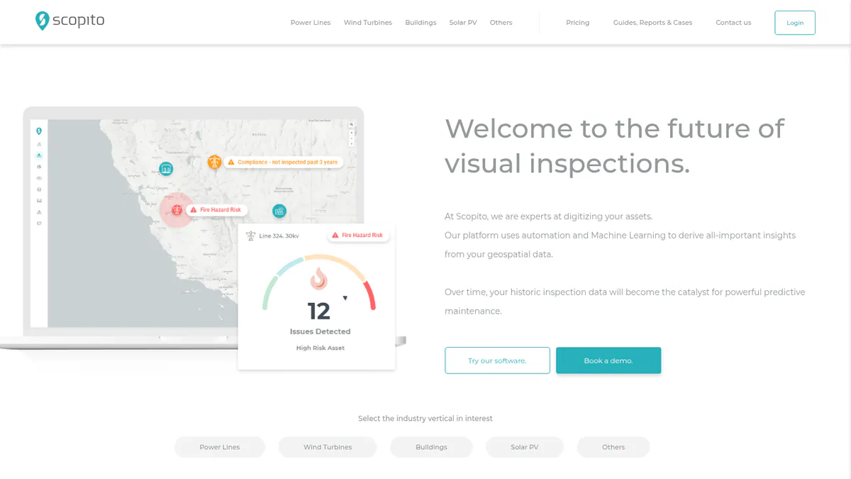
What it is: Scopito is a cloud platform from Scopito ApS in Denmark. It analyses drone images of PV plants, power lines and wind turbines. It does not plan flights: you upload images and it plots faulty panels on a map.
Why we picked it: You pay a published rate per MW, so you can price an inspection before you quote the client. It also holds a G2 rating of 4.9/5 from 23 reviews.
Key features:
- Faulty panels plotted on thermal ortho, CAD, RGB (normal colour) or Google base layers.
- Unlimited image upload on the per-MW plan.
- AI fault detection with optional review by a human expert.
- SAP connection to push faults into work orders.
- White label (your brand on their tool) for drone service providers.
Pricing: Pay Per Asset is EUR 20 per MW inspected, with unlimited image upload. Self-analysis is EUR 0 per MW (limits not stated). Full service is EUR 65 per MW (10 MW minimum) and includes capture planning. For Enterprise you have to ask for a price, and white label starts at EUR 15,000. There is a 14-day trial. Checked October 2026 on the Scopito solar page. It is the only solar-specific platform here with published per-MW prices.
Pros (from our research):
- EUR 20 per MW makes a 50 MW job easy to cost upfront.
- You can buy software only or full service, so you pay for capture only when you need it.
- Drone service firms can resell it under their own brand (white label).
Cons (from our research):
- No flight planning, so you need separate capture software.
- Full service needs a 10 MW minimum, so small sites must fly themselves.
- White label starts at EUR 15,000, a big step up from the per-MW plan.
Reviews: G2 4.9/5 (23 reviews), checked October 2026. Review text and sub-scores sit behind a login. The Capterra listing has no reviews.
What we could not confirm: which drones it supports, and the limits of the free self-analysis tier.
Want to see Scopito working? Book a demo with the SolarSoftwares team.
Book a demoYour request goes by email to the SolarSoftwares team. A time is set only after we reply. It does not change any score or ranking.
4. Raptor Maps: best for docked autonomous drones on utility-scale fleets
Best for: Utility-scale owners and O&M providers who want flights without a pilot on site. Score: 65.6/100.
What it is: Raptor Maps is a solar digital-twin and inspection platform from Raptor Maps, Inc. in Boston. It builds a map of each plant from drone, aircraft, satellite and sensor data. Utility-scale owners, asset managers, O&M teams and EPCs use it.
Why we picked it: Its Solar Sentry docks can fly when a SCADA (plant control system) alarm fires, with no pilot on site. It also takes data from any capture source, so a plant’s history stays in one place.
Key features:
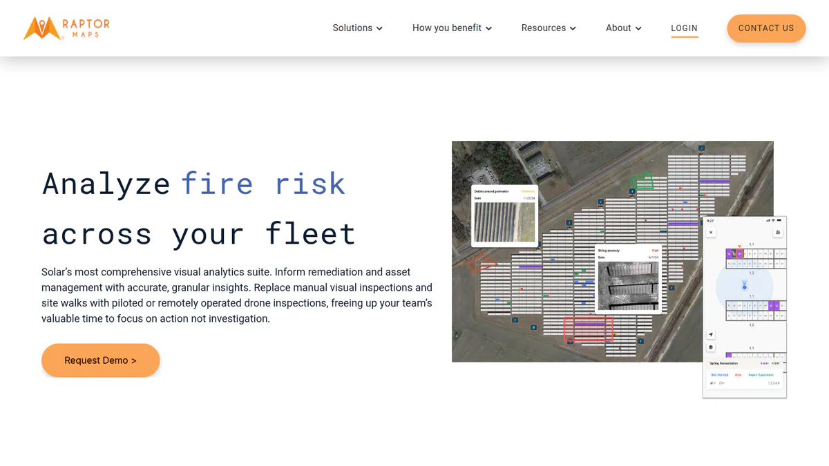
- Raptor Solar Sentry: Docked drones that fly on schedules, SCADA (plant control system) alerts or on demand.
- Drone thermal analytics that put a power and financial loss on each fault.
- An offline-capable app that guides technicians to the fault by GPS.
- Trend and degradation tracking against a global anomaly database.
- API and SCADA data connection.
Pricing: You have to ask the company for a price. Trade press (Solar Builder, November 2021) describes a subscription with unlimited inspection reports. Checked October 2026 on the Raptor Maps website.
Pros (from our research):
- It is the only solar platform here that documents SCADA-triggered missions, so a fault alarm can send a drone with no pilot on site.
- It accepts any capture source, so you keep your history if you change provider.
- A public API and technical docs make it easier to link with your other systems.
Cons (from our research):
- No published prices, and the pricing model is known only from 2021 trade press.
- It is built for utility-scale fleets, which is a lot for a handful of small sites.
- Too few reviews to judge it: none on G2 or Capterra.
Reviews: App Store 4.8/5 (5 ratings) for the field app, checked October 2026. The G2 listing has no reviews.
Read our full Raptor Maps review.
Want to see Raptor Maps working? Book a demo with the SolarSoftwares team.
Book a demoYour request goes by email to the SolarSoftwares team. A time is set only after we reply. It does not change any score or ranking.
5. Zeitview (inspection service with software): best for outsourced aerial capture across large portfolios
Best for: Portfolio owners who outsource capture by drone or aircraft. Score: 60.2/100.
What it is: Zeitview, Inc. (DroneBase until 2023) is mainly an aerial inspection service based in Santa Monica, US. It runs its own Asset Insights software. It bought Heliolytics in September 2023 and says it has inspected 600 GW of PV in 70+ countries.
Why we picked it: It can capture by crewed aircraft as well as by drone, which suits very large portfolios. Its analysts check the AI’s defect calls before you see them.
Key features:
- Capture by drone or crewed aircraft through its own network.
- AI machine vision, with analysts reviewing the defects.
- Asset Insights portfolio map with severity and repair tracking.
- iOS and Android field app.
- API access to inspection data.
Pricing: You have to ask the company for a price, demo only. Checked October 2026 on the Zeitview solar page.
Pros (from our research):
- Crewed aircraft as well as drones let it cover very large portfolios.
- Human analysts review the AI’s defect calls.
- The API lets you use inspection data outside the portal.
Cons (from user reviews):
- One customer reports losing confidence in service quality (Trustpilot).
- A former DroneBase customer found too many points of contact.
- Subcontracted pilots report pay disputes, a risk to capture consistency.
Reviews: Trustpilot 2.6/5 (4 reviews, March 2024 to October 2025), checked October 2026. That sample is too small to judge. No G2 reviews.
What we could not confirm: a bring-your-own-imagery option on the current solar page.
Want to see Zeitview (inspection service with software) working? Book a demo with the SolarSoftwares team.
Book a demoYour request goes by email to the SolarSoftwares team. A time is set only after we reply. It does not change any score or ranking.
6. SenseHawk (TaskMapper / Therm): best for construction-phase drone scans tied to QA and punch lists
Best for: Utility-scale developers and EPCs who scan sites during construction. Score: 58.2/100.
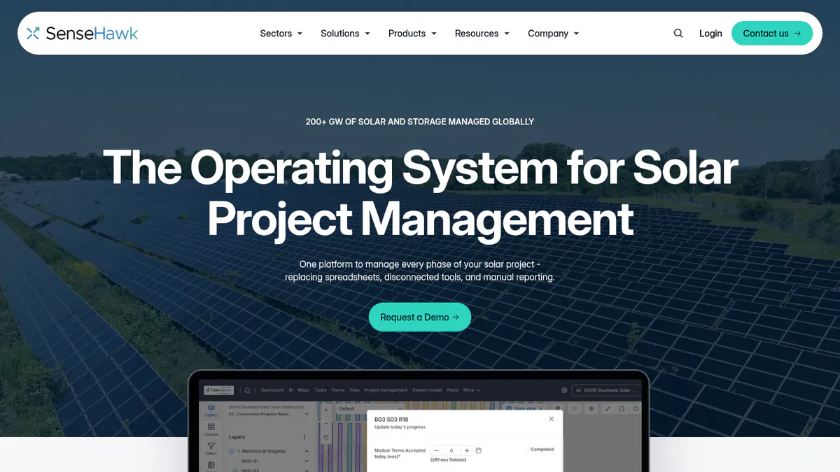
What it is: SenseHawk, Inc. makes a solar digital-twin platform. TaskMapper runs construction progress and QA (quality assurance) on a map, and Therm adds drone visual and thermal analytics. Reliance Industries agreed to buy a 79.4% stake in September 2022. Note: we could not reach sensehawk.com, so its features here come from G2 company text and the SoftwareOne marketplace.
Why we picked it: It ties drone scans to the build map, QA forms and punch lists. That is where EPCs need scan results during construction.
Key features:
- Drone visual and thermal scan analytics with defect locations (Therm).
- Map overlays of design, terrain and irradiance.
- Build progress dashboards, planned against actual.
- No-code QA forms, non-conformance and punch lists.
Pricing: You have to ask the company for a price, per the SoftwareOne marketplace listing, checked October 2026.
Pros (from our research):
- Scans sit beside the design layout and tasks, so crews work from one map.
- It carries site data through the handover from EPC to operations.
- The marketplace listing says it is ISO 27001 (information security standard) certified.
Cons (from our research):
- No flight planning documented, so you need separate capture software.
- No 2025-2026 product news found.
- You have to ask the company for a price, and none is published.
Reviews: G2 4.8/5 for TaskMapper (2 reviews) and 4.5/5 for SenseHawk (2 reviews), checked October 2026. These are too few to rely on.
Want to see SenseHawk (TaskMapper / Therm) working? Book a demo with the SolarSoftwares team.
Book a demoYour request goes by email to the SolarSoftwares team. A time is set only after we reply. It does not change any score or ranking.
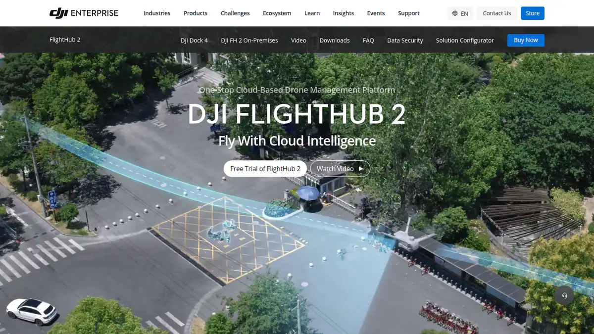
7. DJI FlightHub 2 + DJI Thermal Analysis Tool (general drone software): best for DJI fleets planning routes on a 3D model of the plant
Best for: O&M teams already flying DJI enterprise drones or docks. Score: 55.5/100.
What it is: These are general tools from DJI, not solar software. FlightHub 2 manages drone fleets and docks. Thermal Analysis Tool 3 is a free Windows app for reading temperatures in DJI radiometric images.
Why we picked it: If you already fly DJI, FlightHub 2 plans routes on a 3D plant model and runs docks on a schedule. The thermal tool is free, and the API can pass images to a solar analysis platform.
Key features:
- Route planning on a 3D model of the plant.
- Recurring automated missions with Dock 3 and Matrice 4TD.
- Built-in object detection and Analyzer reports (FlightHub 2).
- Cloud API and OpenAPI to send images to third-party analysis software.
- Spot, line and area temperature readings (Thermal Analysis Tool 3, v3.6.0, December 2025).
Pricing: Thermal Analysis Tool 3 is free (Windows 64-bit, DJI cameras only). FlightHub 2 Enterprise is USD 3,280 per device per year on the DJI Store. Business and Professional versions are listed, but we did not record their prices. Checked October 2026.
Pros (from our research):
- The thermal tool costs nothing.
- You can budget from a published per-device price, and run it on your own servers if data must stay in-house.
- OpenAPI hands images to solar analysis platforms, so you can add one on top.
Cons (from our research):
- No solar fault classification. DJI points users to third-party software for defect detection.
- DJI hardware only, and the thermal tool runs only on 64-bit Windows.
- No user reviews to judge it.
Reviews: No G2 or Capterra reviews as of October 2026.
What we could not confirm: availability under US restrictions on DJI, and the Business and Professional prices.
Want to see DJI FlightHub 2 + DJI Thermal Analysis Tool (general drone software) working? Book a demo with the SolarSoftwares team.
Book a demoYour request goes by email to the SolarSoftwares team. A time is set only after we reply. It does not change any score or ranking.
How do the 7 solar drone inspection tools compare?
Product | Flight planning | Docked drones | Orthomosaic or map output | Who flies | Starting price |
|---|---|---|---|---|---|
Not documented | Not documented (drones and robotics module) | Thermal ortho in platform, not downloadable | You or partner network | Quote only | |
Yes | Yes | Orthomosaics, 3D. Thermal on Advanced | You | USD 4,188/yr | |
No (capture planning in full service) | Not documented | Faults on uploaded thermal ortho, CAD or RGB | You, or full service | EUR 20/MW | |
Sentry missions | Yes (Sentry) | Digital twin from any source | You, any provider or Sentry | Quote only | |
Company-run | Not documented | Asset Insights portfolio map | Company (drone or aircraft) | Quote only | |
Not documented | Not documented | GIS overlays with scan results | Not documented | Quote only | |
DJI FlightHub 2 | Yes, on 3D model | Yes (Dock 3) | Not documented. API to third parties | You (DJI only) | USD 3,280/device/yr |
Also considered
- FlytBase (general dock autonomy software): Scored 55.5/100, tied with DJI, but it placed eighth, just outside the top 7. It runs DJI Dock 2, 3 and 4 across many sites, but it is not solar-specific and sends orthomosaic processing to Pix4D or DroneDeploy. The pricing page leads to a quote, and we could not confirm the Pro plan (USD 99 per month, April 2025) is still sold.
- Above Surveying (SolarGain, service-led): Scored 55.2/100. It is a UK inspection firm in Colchester with its own SolarGain digital-twin platform, which accepts third-party flight data. We could not fetch its website or confirm SolarGain is sold without Above’s services, and it publishes no prices.
- Scanifly (residential design and survey tool): Scored 53.5/100. Its DroneDesign module turns drone photos into a 3D model for US residential design. It is not built to inspect operating plants, and we could not confirm thermal imaging.
- Pix4D (general photogrammetry software, which builds maps and 3D models from photos): PIX4Dmatic builds thermal orthomosaics from radiometric images. It costs from USD 125 per month, with a 15-day trial (checked October 2026). It has no automated solar fault detection, and its solar thermal page dates from 2016. That put it below the minimum score.
- Optelos (general AI visual inspection platform): We found no solar or thermal features on its company pages, so it fell below the minimum score. You have to ask the company for a price.
- PVInspect and Spectralight: Listed by an AI-generated directory, but we could not confirm the products exist.
How do you choose solar drone inspection software?
- Do you have your own pilots and want flight planning and orthomosaics in one subscription? Pick DroneDeploy. Budget for the Advanced plan, which has no public price, if you need radiometric thermal.
- For one solar platform from construction QC to O&M, pick Sitemark, unless you must export the thermal orthomosaic.
- If you already capture images and want a predictable cost per plant, pick Scopito at EUR 20 per MW.
- To inspect without sending pilots, compare Raptor Solar Sentry with DJI Dock 3 plus FlightHub 2. FlytBase (also considered) fits if you run docks across several sites.
- To outsource capture, start with Zeitview. Above Surveying (also considered) is the UK and European option. Ask whether the platform works with another provider’s data.
- Residential installers want a survey and design tool such as Scanifly (also considered), not an inspection platform.
Want more choices? Browse every tool we checked in our aerial and thermal inspection category.
Solar drone inspection software FAQs
Can drones inspect solar panels?
Yes. Drones with RGB and thermal cameras capture a plant in one mission, and inspection software maps the faults. As of October 2026, Sitemark, Scopito and Raptor Maps between them document detection of hotspots, string faults, soiling and cracking from drone images.
How much does solar drone inspection software cost?
Most solar-specific platforms do not publish a price. In October 2026, Scopito charged EUR 20 per MW inspected and DroneDeploy started at USD 4,188 per year for one user. DJI FlightHub 2 Enterprise was USD 3,280 per device per year, and DJI Thermal Analysis Tool 3 was free.
What is the difference between solar inspection software and general drone mapping software?
General drone software plans flights and builds orthomosaics. It does not know what a string (a row of panels) or bypass diode is. Solar inspection software ranks faults per module by severity or energy loss. Pix4D and Optelos fell below our minimum match score for that reason (October 2026).
Do I need my own drone to use solar inspection software?
No. Zeitview flies for you, and Sitemark has a partner capture network. Scopito sells a full-service tier at EUR 65 per MW with a 10 MW minimum (checked October 2026). Raptor Maps also accepts data from planes, satellites and third-party inspection reports.
How often should solar panels be inspected by drone?
None of the company documents we reviewed in October 2026 sets an interval, so check your O&M contract and warranty terms. Docked systems such as Raptor Solar Sentry and DJI Dock 3 run scheduled or alert-triggered missions without a pilot on site.
Sources
All checked 22 to 25 October 2026.
- Sitemark: pricing, solar inspections, drones and robotics, G2, Capterra
- DroneDeploy: pricing, renewable energy, release notes, G2, Capterra
- Scopito: solar PV inspection software and pricing, solar inspection page, G2
- Raptor Maps: website, digital twin docs, API docs, Solar Builder, November 2021, App Store
- Zeitview: solar page, news, Trustpilot
- SenseHawk: SoftwareOne listing, G2 TaskMapper, G2 SenseHawk, pv magazine USA, September 2022
- DJI: PV inspection solution, DJI Store, downloads, Heliguy guide
- FlytBase: pricing, solar page, Pro plan blog, April 2025, G2
- Above Surveying: Intersolar exhibitor listing, pv magazine, December 2024, App Store
- Scanifly: website, product update, G2
- Pix4D: pricing, thermal processing. Optelos: product page
Last updated 28 October 2026. Next scheduled review: 23 January 2027.